|
Awards |
|
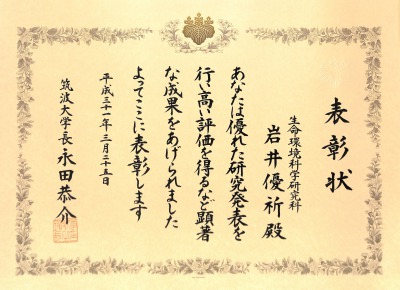
19. The President Award / Yuki Iwai |
|
Award |
The President Award |
|
Winner |
Yuki Iwai |
|
Year |
2019 |
|
Awarded by |
The University of Tsukuba |
|
Contribution |
|
|
Research outline |
|
|
Awards |
|
18. The President Award / Ranagalage Manjula Mahinda |
|
Award |
The President Award |
|
Winner |
Ranagalage Manjula Mahinda |
|
Year |
2019 |
|
Awarded by |
The University of Tsukuba |
|
Contribution |
|
|
Research outline |
|
|
Awards |
|
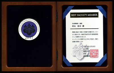
17. BEST FACULTY MEMBER Award 2017 / Professsro Dr. Yuji Murayama |
|
Award |
BEST FACULTY MEMBER Award 2017 |
|
Winner |
Professor Dr. Yuji Murayama |
|
Year |
2017 |
|
Awarded by |
The University of Tsukuba |
|
Contribution |
BEST FACULTY MEMBER honors its activities and honors the teachers who were selected as having excellent activities. The award ceremony was held at the University of Tsukuba on February 19, 2018.
|
|
Research outline |
|
|
Awards |
|
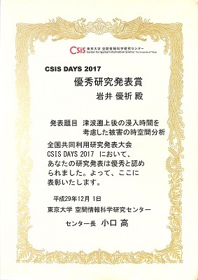
16. CSIS DAYS Excellent Research Presentation Award 2017 /Yuki Iwai |
|
Award |
CSIS DAYS Excellent Research Presentation Award 2017 |
|
Winner |
Yuki Iwai |
|
Year |
2017 |
|
Awarded by |
The University of Tokyo, Center for Spatial Information Science |
|
Contribution |
Spatio-Temporal Analysis of Damage in Consideration of Tsunami Inundation Time |
|
Research outline |
|
|
Awards |
|
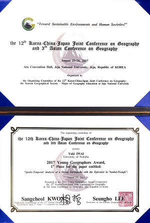
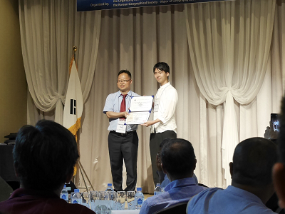
15. 2017 Young Geographers Award, 1st Place for the paper entitled /Yuki Iwai |
|
Award |
2017 Young Geographers Award, 1st Place for the paper entitled |
|
Winner |
Yuki Iwai |
|
Year |
2017 |
|
Awarded by |
The 12th Korea-China-Japan Joint Conference on Geography & 3rd Asian Conference on Geography |
|
Contribution |
Spatio-Temporal Analysis of a Strong Earthquake with the Epicenter in Nankai-Trough |
|
Research outline |
|
|
Awards |
|
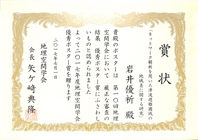
14. Japan Association on Geographical Space Excellence Poster Award 2017 /Yuki Iwai |
|
Award |
Japan Association on Geographical Space Excellence Poster Award |
|
Winner |
Yuki Iwai |
|
Year |
2017 |
|
Awarded by |
Japan Association on Geographical Space |
|
Contribution |
A Study on Regional Difference of Tsunami Evacuation Area Using Network Analysis |
|
Research outline |
|
|
Awards |
|
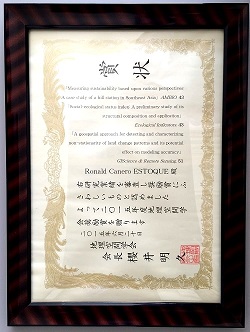
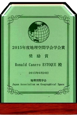
13. Research Excellence Award for Young Scholars 2015 / Dr. Ronald C. Estoque |
|
Award |
Research Excellence Award for Young Scholars |
|
Winner |
Dr. Ronald C. Estoque |
|
Year |
2015 |
|
Awarded by |
Japan Association of Geographical Space |
|
Contribution |
Original publications in GIScience & Remote Sensing, AMBIO, and Ecological Indicators. |
|
Research outline |
|
|
Awards |
|
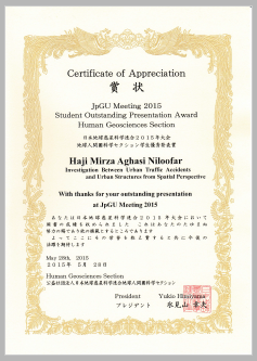
12. JPGU (Japan Geoscience Union) Student Outstanding Presentation Award 2015 / Mrs, Niloofar Haji Mirza Aghasi |
|
Award |
JPGU (Japan Geoscience Union) Student Outstanding Presentation Award |
|
Winner |
Mrs, Niloofar Haji Mirza Aghasi |
|
Year |
2015 |
|
Awarded by |
Japan Geoscience Union, 2015, Japan |
|
Contribution |
Spatial analysis of urban traffic and urban structure |
|
Research outline |
|
|
Awards |
|
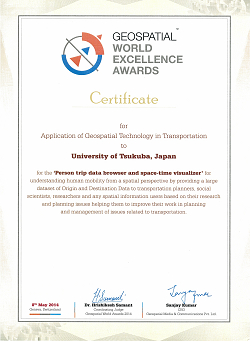
11. Geospatial World
Excellence Awards 2014/Professor Dr. Yuji Murayama and
Dr. Ko Ko Lwin |
|
Award |
2014 Geospatial World Excellence Award |
|
Winner |
Professor Dr. Yuji Murayama and Dr. Ko Ko Lwin |
|
Year |
2014 |
|
Awarded by |
Geospatial
World Forum 2014, Geneva, Switzerland |
|
Contribution |
Person Trip Data Browser and Space Time Visualizer |
|
Research outline |
|
|
Awards |
|
10. 2013 Sinfonica GIS and Statistics
Research Grant/Mr. Gerasimos Voulgaris |
|
Award |
2013 Sinfonica GIS and Statistics Research Grant |
|
Winner |
Mr.
Gerasimos Voulgaris |
|
Year |
2013 |
|
Awarded by |
Statistical Information Institute for Consulting and Analysis, Japan |
|
Contribution |
|
|
Research outline |
|
|
Awards |
|
9. 2012 Sinfonica GIS and Statistics
Research Grant/Mr. Konstantin Greger |
|
Award |
2012 Sinfonica GIS and Statistics Research Grant |
|
Winner |
Mr. Konstantin Greger |
|
Year |
2012 |
|
Awarded by |
Statistical Information Institute for Consulting and Analysis, Japan |
|
Contribution |
|
|
Research outline |
|
|
Awards |
|
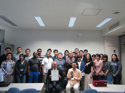
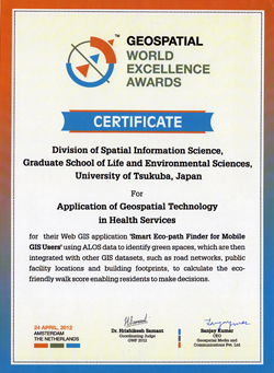
8. Geospatial World Excellence Awards
2012/Professor Dr. Yuji Murayama and Dr. Ko Ko Lwin |
|
Award |
Geospatial World Excellence Awards 2012 |
|
Winners |
Professor Dr. Yuji Murayama and Dr. Ko Ko Lwin |
|
Year |
2012 |
|
Awarded by |
Geospatial
World Forum 2012, Amsterdam, Netherlands |
|
Contribution |
Smart-Ecopath
Finder for Mobile GIS Users |
|
Research outline
|
|
|
Awards |
|
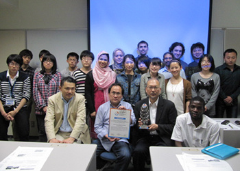
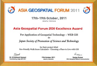
7. Asia Geospatial Forum 2011 Excellence Award /Professor Dr. Yuji Murayama and Dr. Ko Ko Lwin |
|
Award |
Asia Geospatial Forum 2011 Excellence Award for Application of Geospatial Technology
- WEB GIS |
|
Winners |
Professor Dr. Yuji Murayama and Dr. Ko Ko Lwin |
|
Year |
2011 |
|
Awarded by |
Asia Geospatial Forum (AGF) 2011 |
|
Contribution |
Eco-friendly Walk Score Calculator: Choosing a Place to Live with GIS,
sponsored by Japan Society of Promotion of Science and
Technology |
|
Research outline |
To develop an integrated methodology (Remote Sensing, GIS and Spatial Web Technology) to model urban green space walkability, which enables local residents to make informed decisions that will improve their living conditions and physical health related to the neighbourhood environmental quality.
|
|
6.Outstanding Research Award of Year (2010) /Dr. Ko
Ko Lwin |
|
Award |
Outstanding Research Award of Year |
|
Winner |
Dr. Ko Ko Lwin |
|
Year |
2010 |
|
Awarded by |
Graduate School of Life and Environmental Sciences,
University of Tsukuba, Japan. |
|
Contribution |
Online Micro-spatial Analysis
Based on GIS Estimated Building Population: A Case Study
of Tsukuba City |
|
Research outline |
This research aims to develop a new dasymetric mapping
technique based on building footprints and census tracts
by utilizing LIDAR derived Digital Volume Model DVM and
integrated with NTT iTownpage (Nippon Telegraph &
Telephone Corp. Internet town page) information. This
will enhance not only data precision in population
mapping but also population data analysis at micro-scale
level which is essential for disaster management and
emergency preparedness, public facility management in
urban planning, consumer and retail market analysis,
environment and public health programs, and other
demographic studies.
|
|
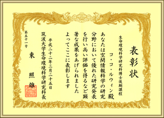
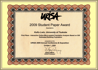
5.First Place Award in URISA's Student Paper
Competition (2009) /Ko Ko Lwin |
|
Award |
First Place
Award in URISA's Student Paper Competition |
|
Winner |
Ko Ko Lwin, PhD Candidate |
|
Year |
2009 |
|
Awarded by |
URISA Urban and Regional Information System Association, USA. |
|
Contribution |
Interactive Online Micro-spatial Population Analysis
Based on GIS Estimated Building Population |
|
Research outline |
Spatial distribution patterns of population is fully depend on landscape structures and never be a homogeneous, especially where the city has a mix of high and low-rise buildings or patched with unpopulated large spaces such as paddy fields or parks or playgrounds or governmental institutions. This will introduce some errors in population data analysis at micro-scale level.
Moreover, spatial analysis functions using building
population data is absolutely rare or absent in GIS
arena because building population information is not
available for public use due to privacy concerns. The
goal of this paper is to introduce an online interactive
micro-spatial population analysis based on building
population, which was estimated from LIDAR derived Digital Volume Model DVM and
integrated with NTT iTownpage (Nippon Telegraph &
Telephone Corp. Internet town page) information.
|
|
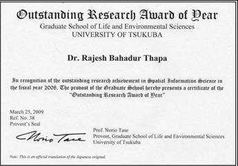
4.Outstanding Research Award of Year(2009)/Dr. Rajesh Bahadur Thapa |
|
Award |
Outstanding Research Award of Year |
|
Winner |
Dr. Rajesh Bahadur Thapa |
|
Year |
2009 |
|
Awarded by |
University of Tsukuba, Japan |
|
Contribution |
Spatial process of urbanization in Kathmandu Valley, Nepal. |
|
Research outline |
This research investigated the spatial pattern of urbanization since the 1960s and identified the driving factors of urbanization. Remote sensing, geographic information systems, spatial metrics, analytic hierarchy process, and fieldwork techniques were applied in order to prepare time series land use maps, interpret spatial pattern changes, and analyze the urbanization process. The urban built-up areas, which are used as an indicator of urbanization, had a slow trend of growth in the 1960s and 1970s but have grown rapidly since the 1980s. Prime agricultural land in the valley floor has been changed to urban/built-up areas. The urbanization process of individual uncontrolled housing practices has developed fragmented and heterogeneous land use combinations in the valley, but urban growth has gradually become more synchronized in recent decades. The dynamic pattern of urbanization, particularly for the last decade, has been greatly influenced by seven driving factors: physical conditions, public service accessibility, economic opportunities, land market, population growth, political situation, and plans and policies. These factors have played important but different roles in the core, fringe, and rural areas. Among these factors, economic opportunities in the core, population growth in the fringe, and the political situation in the rural areas are identified as the highest impact factors of urbanization. The physical conditions factor has had the least effect in the core and fringe areas as compared to its role in the rural areas. The role of public service accessibility gradually decreased from city core to rural area. Due to the lower land availability in the city core, the land market factor had less of a role in the core compared to the fringe and rural areas. The plans and policies factor is evaluated as less effective in all thematic areas. This empirical analysis revealed the spatial process of urbanization in the valley, which is an important reference for the urban and regional planners in Nepal and other less developed countries.
|
|
3.Young GIS Professional Award(2008)/Chiaki Mizutani |
|
Award |
Young GIS Professional Award |
|
Winner |
Chiaki Mizutani, PhD Candidate |
|
Year |
2008 |
|
Awarded by |
Asia GIS 2008 |
|
Contribution |
Identifying the spatial-temporal relation between population distribution and land use dynamics |
|
Research outline |
The study identified spatial-temporal relations between land use dynamics and population distribution pattern in Tsukuba city using GIS techniques. Land-use maps for 1984, 1989, and 1994 and Grid Square Statistics data for 1990, 1995, and 2000 were used for analysis. Multiple regression analysis was performed separately with nine major land uses: forest and waste, crop, vacant, industrial, residential, commercial, road, public facilities, and water. The trend of land use distribution of residential area was concentrated around science city during 1989 to 1994 as compared to 1984 to 1989. However, the concentration of population density clusters in 1995 and 2000 were in and around the new development of residential area in 1994. The regression analysis shows the changes of residential area played greater roles to change the population than the other land uses change during the first time period while the residential area led to change the population dy namic in later years.
|
|
2.Young GIS Professional Award(2007)/Dr. Yaolong Zhao |
|
Award |
Young GIS Professional Award |
|
Winner |
Dr. Yaolong Zhao |
|
Year |
2007 |
|
Awarded by |
Geographic Information System Association, Japan |
|
Contribution |
Dynamic analysis of the neighborhood effect in urban geosimulation: A case of the Tokyo metropolitan area. |
|
Research outline |
This research aimed at providing and empirical analysis of the dynamics of neighborhood effect in the process of urban growth to support urban geosimulation models using the Tokyo metropolitan areas as a case study. Constrained CA model was used to simulate the urban growth in the Tokyo metropolitan area in 1994. Compared with actual land-use pattern in 1994, the results of simulation are discussed at both of macro classification scale and micro classification scale in four ways: quantitative comparison through cell-by-cell, comparison of spatial form of urbanized area through fractal dimension, comparison of urban landscape through spatial metrics, and regional characteristics analysis. The research indicated that although neighborhood effect is different for the transformation probability of every active land-use type, during certain relatively long time period it keeps stable in the process of urban growth.
|
|
1.Sinfonica Statistical GIS Research Grants(2007)/Rajesh Bahadur Thapa, Chiaki Mizutani |
|
Award |
Sinfonica Statistical GIS Research Grants |
|
Winners |
Rajesh Bahadur Thapa, Chiaki Mizutani |
|
year |
2007 |
|
Awarded by |
Statistical Information Institute for Consulting and Analysis, Japan |
|
Contribution |
Tsukuba Revitalization Project |
|
Research outline |
This study investigated the spatiotemporal landscape and relationship of socioeconomic indicators over time in Tsukuba city using 1km mesh Grid Square Statistic data and the other available relevant data. The spatial patterns of population distribution and its changes were mapped for the year 1990, 1995 and 2000, similarly, spatial patterns of economic indicators distributions for the year 1991, 1996 and 2001. The relationship of the distribution patterns of the indicators, changes and impact to the population growth were investigated. The land use changes and its impact to the socioeconomic dynamics over time were highlighted. The study found the spatial disparities in population growth, concentration of population, uneven distribution of economic activities that made the city core populated and face depopulation in adjacent semi-rural areas. Based on the spatial distribution patterns of various indicators and its changes over time, the analysis showed good academic and research environment can play crucial role in the city revitalization through population growth with socio-cultural diversities. It is also an important aspect of modern human settlement. Tsukuba science city pulled young generation and economically active population that had many impacts in various aspects, i.e. land uses, economic, public facilities, social cultural, natural environment, etc. All these aspects reflected well to establish modern city with diversified cultures in the Tokyo metropolitan fringe.
|