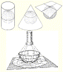
| Map Projection |
|
|
|
|
|
|
|
|
| n | A map
projection is a method of representing |
||||||
| the earth's
three-dimensional surface as a flat |
|||||||
| two-dimensional
surface. This normally involves |
|||||||
| a mathematical
model that transforms the |
|||||||
| locations of
features on the earth's surface to |
|||||||
| locations on a
two-dimensional surface. |
|||||||
|
|
|
|
|
|
|
|
|
|
| n | Because the
earth is three- |
||||||||
| dimensional,
some method |
|||||||||
| must be used to
depict the map |
|||||||||
| in two
dimensions. Therefore |
|||||||||
| such
representations distort |
|||||||||
| some parameter
of the earth's |
|||||||||
| surface, be it
distance, area, |
|||||||||
| shape, or
direction |
|||||||||