
| Spatial Reference Surfaces and Datums |
|
|
|
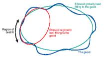
| The
geoid as the globally |
||
| best
fitting ellipsoid |
||
|
|
|
|
|
|
|
|
|
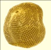
| Geoid
– a level surface |
||||||||
| approx.
to Earth`s ocean |
||||||||
| Using the geoid
and ellipsoid, |
||||||||
| geographical
coordinates |
||||||||
| can be assigned
Cartesian |
||||||||
| coordinates
using a method |
||||||||
| of projections |
||||||||