ArcGIS Online Data for National Land Numerical Information download service in Tokyo and Ibaraki(2016.11Vison)
Tokyo(PDF)New
Ibaraki(PDF)New
Tokyo and Ibaraki(Excel)New
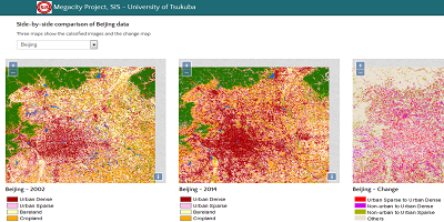
Mega-cities Project: Visualization and downloading of the land use/cover dataset of Chinese major megacities

Visualization and downloading of the land use/cover dataset of Chinese major megacities
Mega-cities Project: Visualization and downloading of the land use/cover dataset of Asian major megacities
Visualization and downloading of the land use/cover dataset of Asian major megacities
Mega-cities Project: Urbanization in Major Asian and African Cities
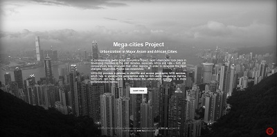
Urbanization in Major Asian and African Cities
Urbanization in Major Asian and African Cities

Urbanization in Major Asian and African Cities
<
Meiji Era (By Prefecture) Statistics for GeoWeb
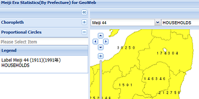
Meiji Era (By Prefecture) Statistics for GeoWeb
Geovisualization to Urbanization Web-GIS

Geovisualization to Urbanization Web-GIS
Land-Use/Land-Cover Changes in Major Asian and African Cities

Land-Use/Land-Cover Changes in Major Asian and African Cities
Asia Cities Person Trip
Data Browser and Analyzer
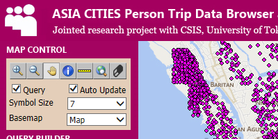
Person
trip data browser and analyzer for Asia cities
Person trip data browser and analyzer
for Bangladesh, Hanoi, Jakarta and Manila
Persontrip Space-Time
Visualizer
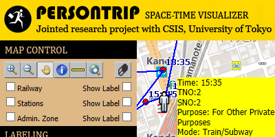
Persontrip
Space Time Visualizer
Space-Time visualization of person
movement by time based on gender, age-group, occupation, purpose and
transportation mode (Jointed research project with CSIS Center for
Spatial Information Science, University of Tokyo).
Person Trip Data
Browser and Analyzer
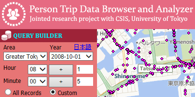
Person Trip
Data Browser and Analyzer
Data browser and analyzer for person
trips mega public survey data (Jointed research project with CSIS
Center for Spatial Information Science, University of Tokyo).
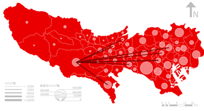
Traffic Flow Pattern
in Tokyo
Based on the
person trip data, various inter-regional flow patterns are
visualized in the Web-GIS.
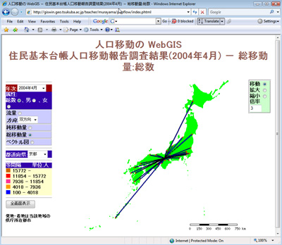
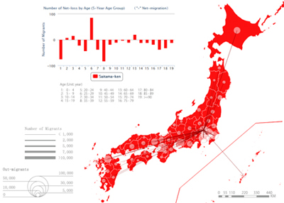
Population
Movement in Japan
Interactive visualization of monthly
population movement in Japan.
Development of
Centralized Field Data Collection, Processing and Analyzing System
for Spatial Information Users

Campus GIS (Tsukuba University
campus geospatial information)
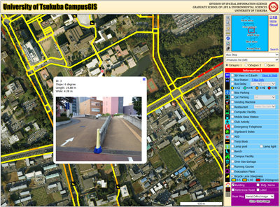
Read more about this project at: Web-based GIS System for
Real-time Field Data Collection Using Personal Mobile Phone,
Journal of Geographic Information
Systems, 3(4):382-389.
Campus GIS
Choosing a
place to live with GIS: Eco-friendly walk score
calculator for Tsukuba City
(2011 Asia
Geospatial Excellence Award winning project)
Project Homepage
(About the project)
-
Check your neighborhood green
intensity
-
Check your eco-friendly walk score
before you move to Tsukuba City
-
Check your desire facilities that
you can go by walking
-
More ...
Read more about this research at Asia Geospatial Forum 2011
Conference, "Eco-friendly Walk Score Calculator: Choosing a Place to
Live with GIS", October 17-19, Jakarta, Indonesia.
Read more
about this research at Computers, Environment and Urban
Systems Journal.
Read more about this research at The 5th Japan-Korea-China Joint
Conference on Geography (Green Society in East Asia: A Geographical
Contribution) conference, November 7-10, Tohoku University, Sendai,
Japan.
Online Demo in Japanese
Online Demo in English
Smart Eco-path
Finder: Find shortest vs.
greenest path on your smart phone
(2012 Geospatial
World Excellence Award winning project)

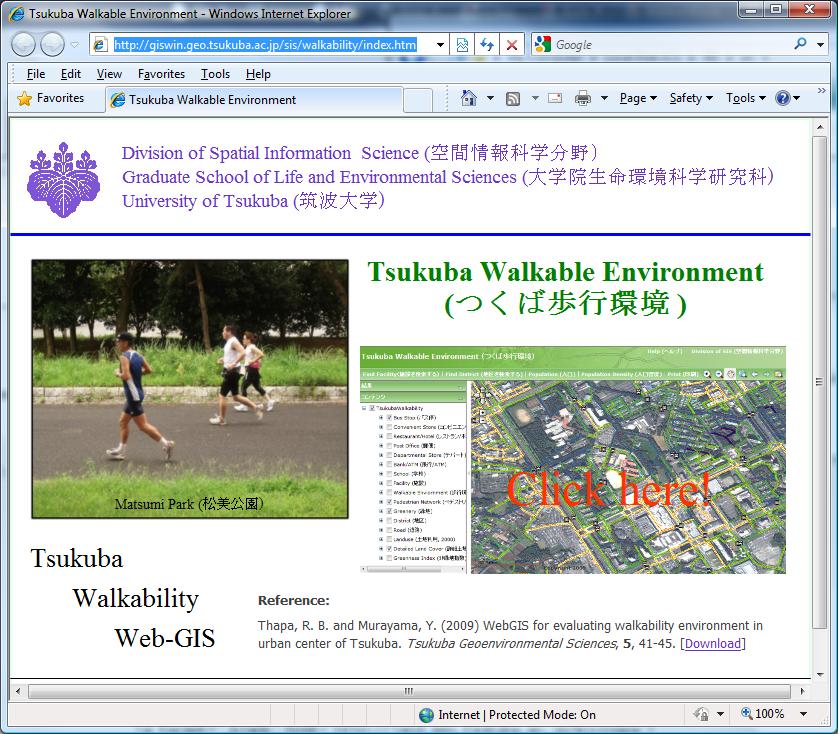
Tsukuba City
Walkable Environment
Tsukuba Walkable Environment
MICROSPA is
online interactive micro-spatial population analysis based on GIS
estimated building population as a case study of Tsukuba City
Central Area. You can try not only GIS basic functions (find
address, measure distance, query attribute, etc.) but also perform
advanced spatial analysis, examples are web-based interactive
decision-making tool for local community bus route planning, finding
population mean center for business site selection, disaster
management and emergency preparedness, finding connectivity mean
center for site evaluation and more.
Read more about this research (user guide) ,
Go to
MICROSPA
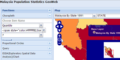
Interactive Map of Malaysia Population Statistics
Internet GIS for Population Statistics of Malaysia
Interactive Map of
Japan Demographic Flow Patterns
Monthly demographic flow patterns in Japan
Interactive Map of
Meiji Historical Statistics
Historical Statistics in Meiji Period
More WebGIS
projects