 |
||
|
|
Welcome!
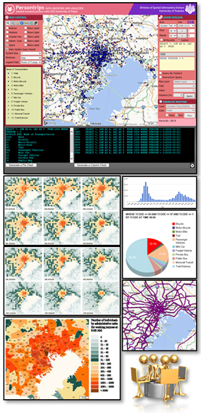
Welcome to “Person trip data browser and space-time visualizer" project homepage.
Understanding human mobility from a spatial perspective is important to urban transport planners, human geographers, social scientists and other spatial information users to improve public transport systems and socio-economic planning.
Advances in wireless communication technology and location enabled devices enable to collect, store and integrate large amounts of geospatial data including sensor network data, mobile phone log data, real-time weather information, person flow data etc.
However, handling of these Big Data requires high-speed computational power, complex database management systems and considerable period of time to extract, manipulate and analyze the data for end users. There fore, this project aims:
This project is a jointed research project with People Flow (PFLOW) project, CSIS, University of Tokyo.
|
|
|
|
||
|
|
||
|
© 2012 Division of Spatial Information Science, University of Tsukuba |
||